Local Area
Llangurig, Rhayader and the upper Wye Valley
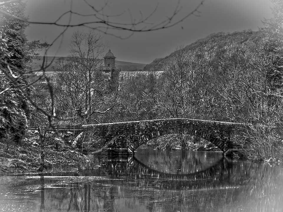
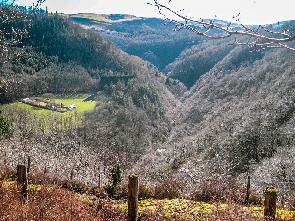
Dernol is situated within the Cambrian Mountains, 5 miles by road south of the village of Llangurig, and 6 miles by road from the small town of Rhayader / Rhaeadr, which is popular with walkers and visitors owing to its proximity to the popular Elan Valley and its reservoirs. About 3 miles from Dernol is Radnorshire Wildlife Trust’s Gilfach nature reserve with its rich assortment of wildlife.
Rather than go into detail about these local places on this website, there are links to more comprehensive information in their sections below.
Llangurig

Llangurig is the first village on the River Wye, about 10 mls. from the river’s source on Plynlimon. The village has a chuch, St. Curig’s, dating from the 15th. century (though there was an earlier one on the site), two pubs, a craft shop and a busy and popular Post Office / shop.
Llangurig Community Council’s website
Llangurig (Wikipedia)
Photos of Llangurig on the People’s Collection Wales / Casgliad y Werin Cymru website.
St. Curig’s Church
The village church is listed grade II* as a large medieval church, though retaining only the tower and some re-used window masonry of the original church, together with the font. Otherwise it is a Victorian restoration funded by local patronage, undertaken by two notable church architects, Sir George Gilbert Scott and Arthur Baker, in 1877/8. Read more on the British Listed Buildings website : St. Curig’s Church
Clochfaen
Clochfaen is a historic house just outside the main village, set in woodland overlooking the River Wye, and is noted for its architecture after it was rebuilt in 1915 in the Arts & Crafts style by W.A. Benson. Read more on the Coflein website : Clochfaen
A BBC article about Prince Albert’s stay at Clochfaen in 1917 : How a village in Powys helped the future George VI
‘The History of the Parish of Llangurig’
by Edward Hamer and Howel William Lloyd
This book was originally published in 1875, compiled partly from the Montgomeryshire Collections and Archaeologica Cambrensis. As well as a few details of local neolithic features, it also covers the history of the family at Clochfaen from the 5th century AD, as well as other local families and landowners. It also has a section of local Welsh poetry.
Long out-of-print, it is now available again in various digital formats, and print, courtesy of the Internet Archive . The original book has been automatically scanned, which is not a foolproof method of reproduction, so there are many layout and spelling problems, but it is still very useable and interesting. The History of the Parish of Llangurig
The Railway that almost came to Llangurig.
The Llangurig Branch railway line (Wikipedia)
Llangurig Railway Station (Wikipedia)
Manchester & Milford Railway Company (1860 – 1907)
There are some photos of traces of this line on the People’s Collection Wales website, as linked to above.
Llangurig Lake

For a time there was a boating lake at Llangurig, in what is now fields alongside the main road leading from Llangurig roundabout towards Llanidloes. It wasn’t there in 1866, but was there in 1903 (see map below), where it is referred to as Tanyllwyn Lake. It was filled in sometime in the early C20. If you know any more about it please let me know – I don’t remember the time when this wasn’t all fields!
1903 map of Llangurig on the Victorian Powys website
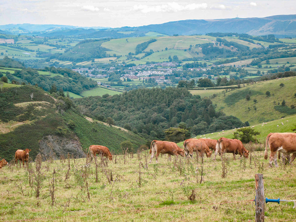
Rhayader

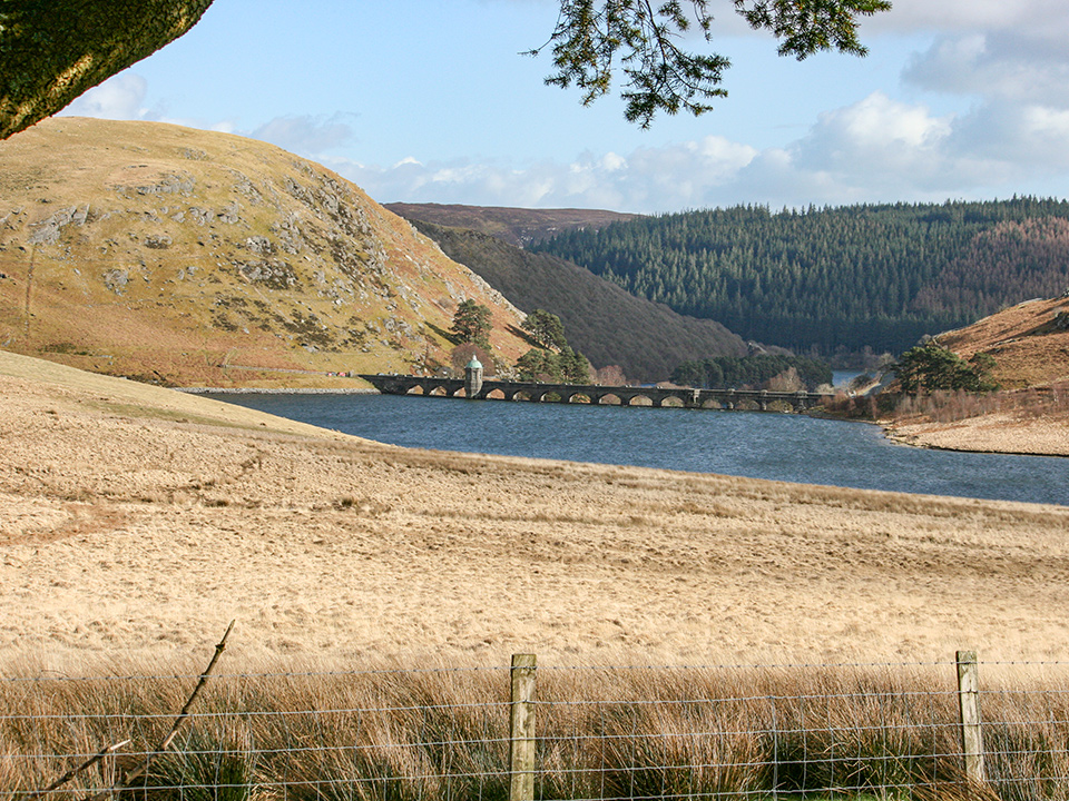
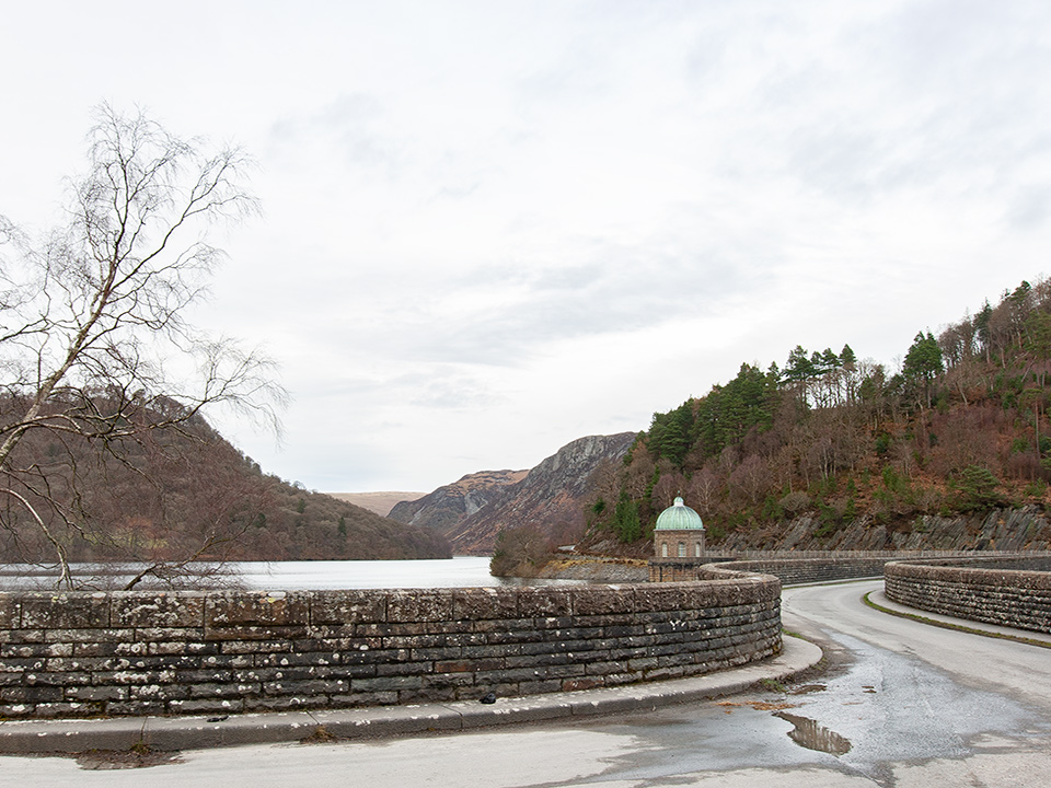
Rhayader / Rhaeadr Gwy is the first town on the River Wye, about 20 miles from the river’s source; it is in the old county of Radnorshire, now part of Powys. It is popular with visitors as it is the ‘gateway to the Elan Valley’, a beautiful and spectacular series of reservoirs built between 1894 and 1904 (though Claerwen dam / reservoir was built later, opening in 1952) to supply water to Birmingham (fed by gravity alone!).
Since 2015, the town has had the good fortune to have an excellent music venue, The Lost Arc, something that has long been needed in Mid Wales. It has been host to some excellent touring live bands (including Henge, Pama International, Mighty Vipers, Solana, Regime, Last Tree Squad, Tír na nÓg, Soothsayers), as well as DJ nights and many community events. The café’s well worth a visit too!
We’re looking forward to many more good nights there once the ‘COVID-19 Experience’ is over (the Jimi Hendrix Experience was far better in my opinion!). We had a reggae / dub soundclash (Dubbin meets Gorgon Hi-Power) and a funk night (On The One) booked there for myself and some fellow DJs before everything had to be cancelled, which will hopefully be re-arranged before too long.
The Radnorshire Society, established in 1930, is concerned with the archaeology and history of the historic county of Radnorshire (now part of Powys). It provides a programme of public lectures and field trips, maintains an archive and publishes an annual newsletter.
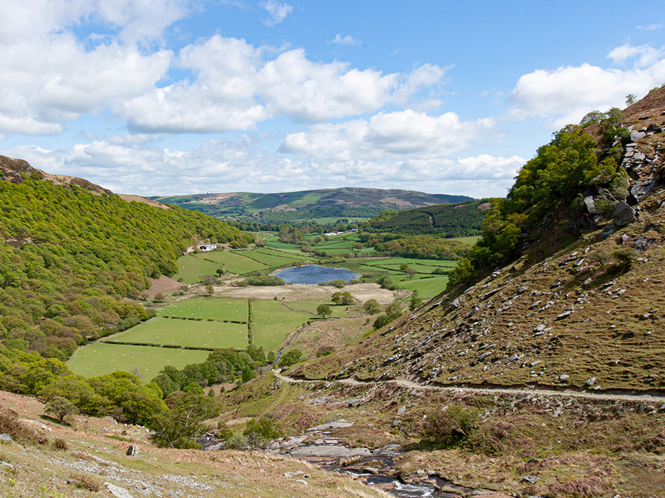
Gilfach Nature Reserve

For centuries Gilfach was a working hill farm, on which chemical fertilisers, herbicides and pesticides have never been used, and now it’s a spectacular nature reserve tucked away in the Marteg Valley in the heart of rural Mid Wales.
55 species of breeding bird and 413 species of lichen have been observed there, and there is a ‘salmon leap’ on the Afon Marteg. It is still grazed at certain times of the year by livestock to conserve its wildlife richness.
Read more on the Radnorshire Wildlife Trust’s website : Gilfach Nature Reserve
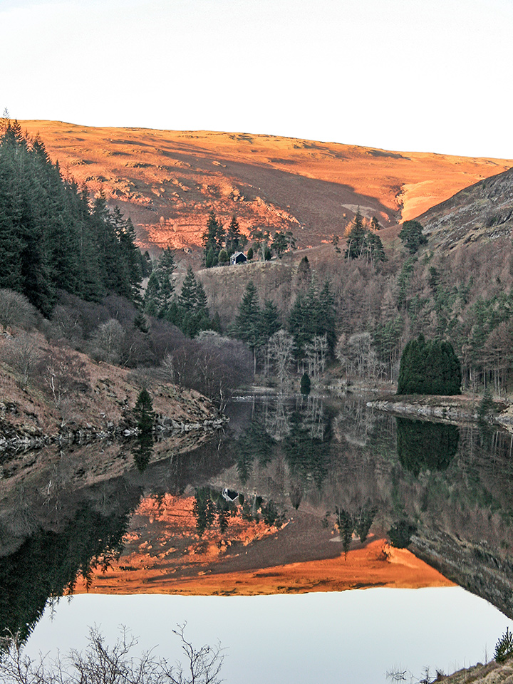
Elan Valley

Part of the rugged Cambrian Mountains, Elan is a beautiful and unspoilt area with five dams and reservoirs, which together create a wonderful, living landscape.The Elan Estate (72 square miles) is a haven for wildlife, one of the most important sites in Wales. The whole area falls within the Cambrian Mountains Environmentally Sensitive Area (ESA), is a Special Protection Area (SPA) for wild birds, has Special Areas of Conservation (SAC) for habitats and most of the land has been designated as various Sites of Special Scientific Interest (SSSI).
Read more on the Elan Valley website
Below is a gallery of some of my Elan Valley photos.
Elan Valley – a few favourites from the gallery below

Omocestus viridulus (Common Green Grasshopper )
Omocestus viridulus (Common Green Grasshopper )

Penygarreg reservoir
Penygarreg reservoir

Graig Dolfaenog
Graig Dolfaenog
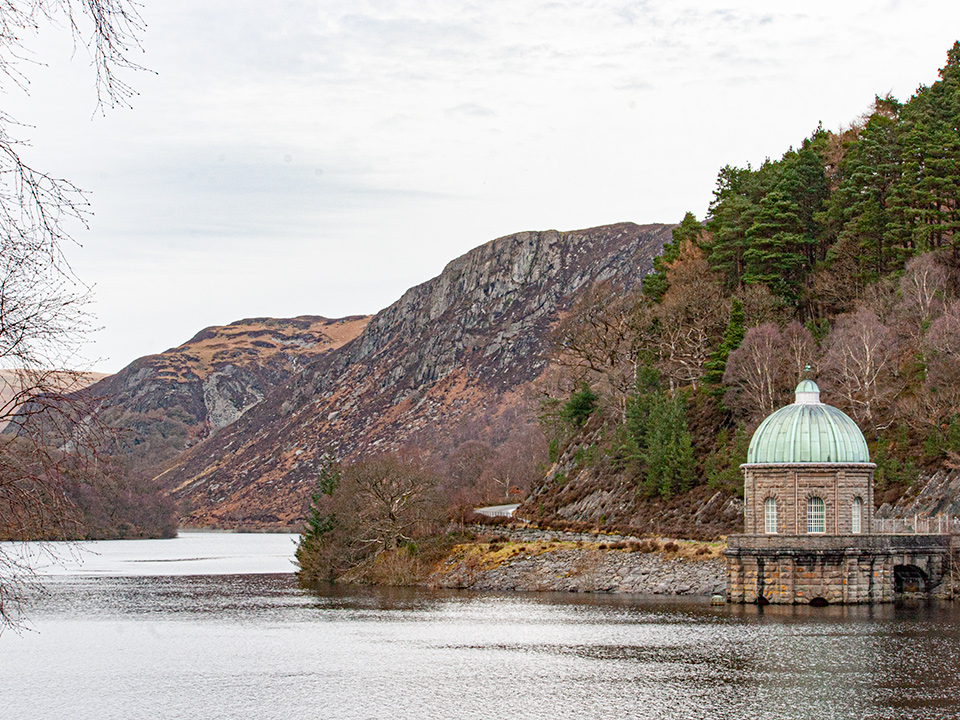
Garreg-ddu Reservoir
Garreg-ddu Reservoir

Claerwen Reservoir
Claerwen Reservoir
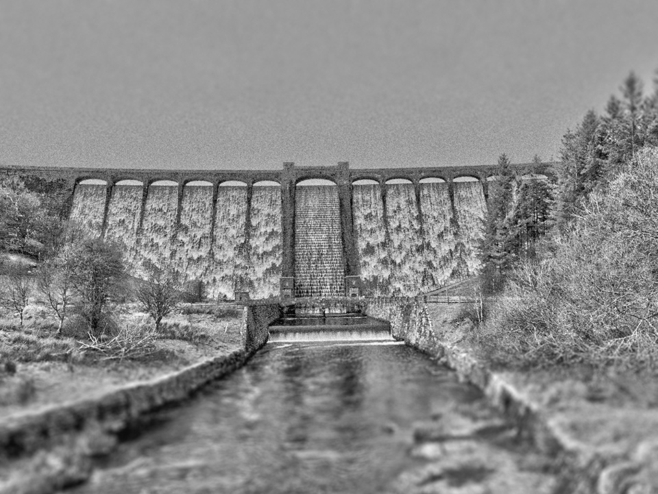
Claerwen dam
the main face of the Claerwen dam

Afon Claerwen
Afon Claerwen

Penglaneinon Meadow
Penglaneinon Meadow
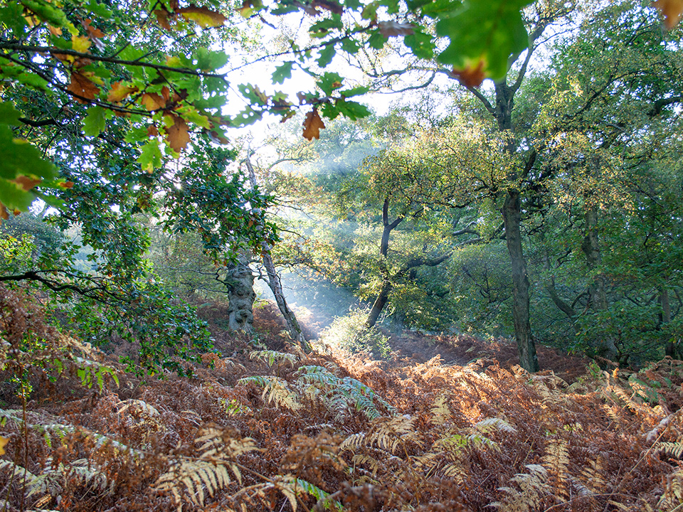
IMG_0172_960
in Cnwch Wood
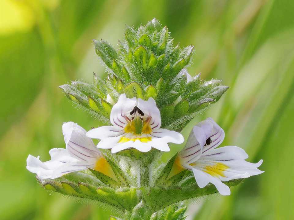
Euphrasia (Eyebright) (7057-62)_3_st6_960
Euphrasia sp. (Eyebright)
Elan Valley – main gallery

1293 Chrysoteuchia culmella (Garden Grass Veneer)
Chrysoteuchia culmella (Garden Grass Veneer)
Euphrasia (Eyebright) (7057-62)_3_st6_960
Euphrasia sp. (Eyebright)

Dactylorhiza maculata (Heath Spotted-orchid)
Dactylorhiza maculata (Heath Spotted-orchid)
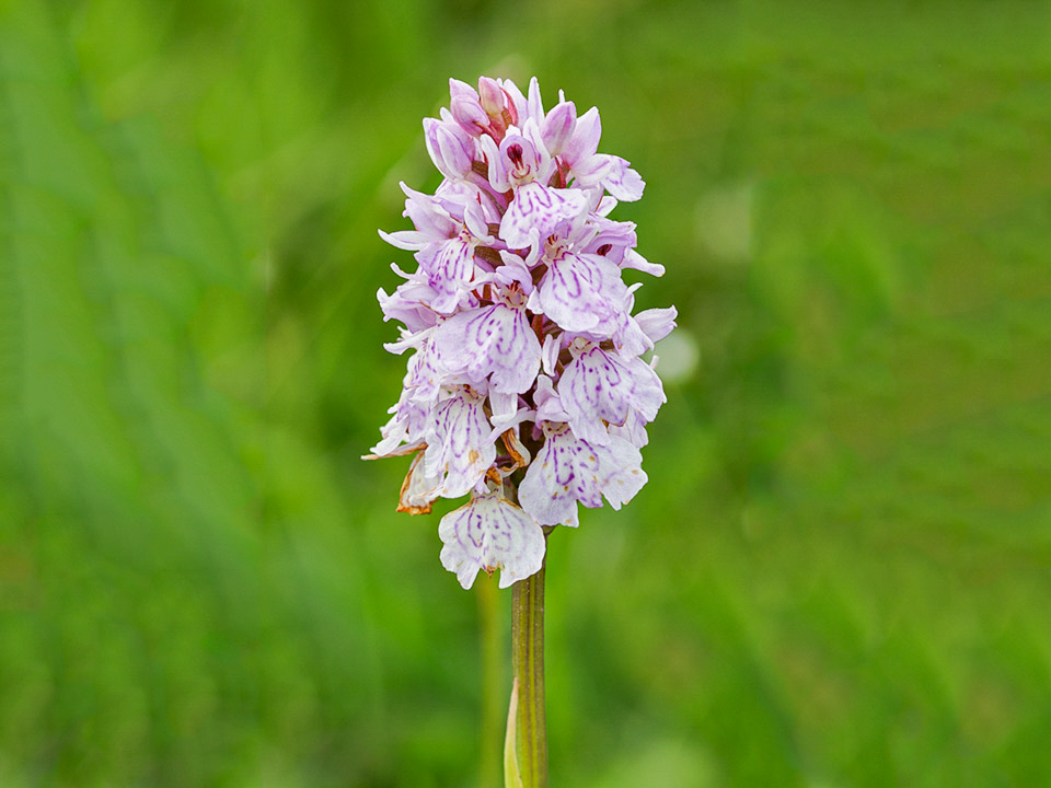
Dactylorhiza maculata (Heath Spotted-orchid)
Dactylorhiza maculata (Heath Spotted-orchid)

Elan Valley
Elan Valley

Elan Valley
Garreg-ddu Reservoir, Elan Valley
Omocestus viridulus (Common Green Grasshopper )
Omocestus viridulus (Common Green Grasshopper )

Penglaneinon Meadow
Penglaneinon Meadow

Penglaneinon Meadow
Penglaneinon Meadow
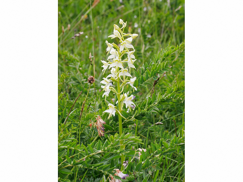
Platanthera chlorantha (Greater Butterfly-orchid)
Platanthera chlorantha (Greater Butterfly-orchid)
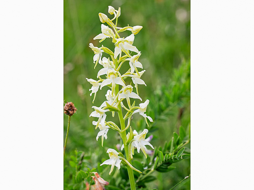
Platanthera chlorantha (Greater Butterfly-orchid)
Platanthera chlorantha (Greater Butterfly-orchid)

Afon Claerwen
Afon Claerwen

Claerwen Dam
Claerwen Dam

Claerwen Dam
Claerwen Dam
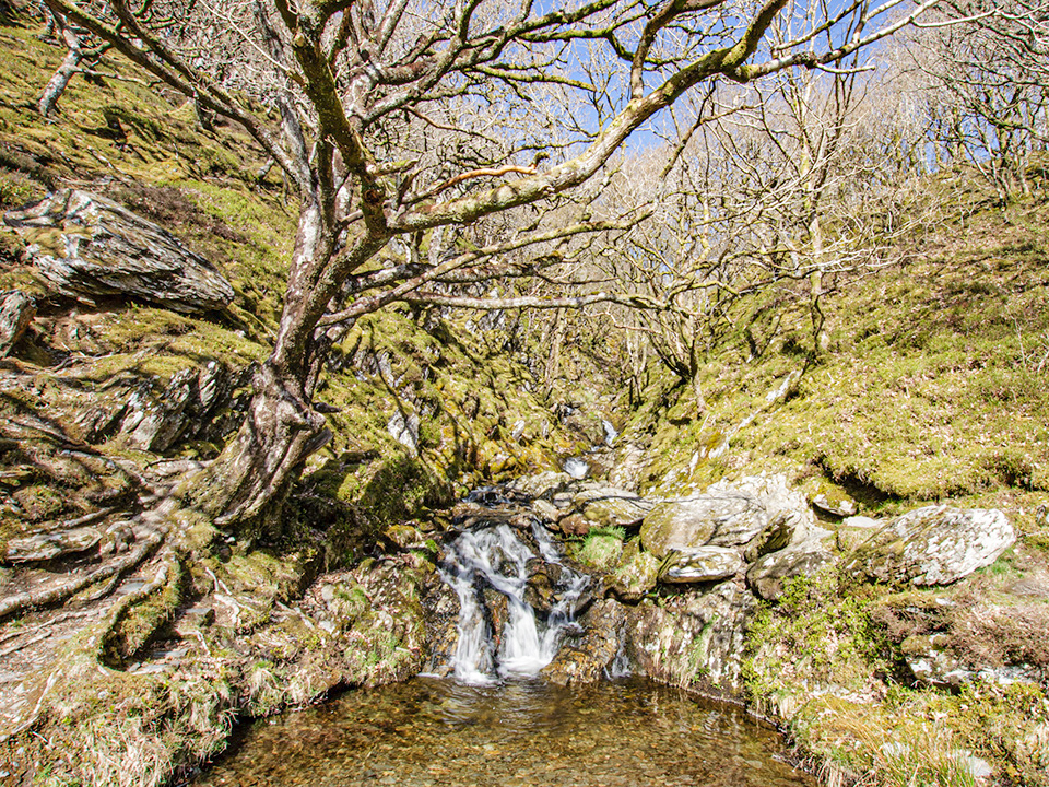
Nant Dolfolau, Elan Valley
Nant Dolfolau

Nant Dolfolau, Elan Valley
Nant Dolfolau

Craig Goch Reservoir
Craig Goch Reservoir

Ice near Claerwen dam
Ice near Claerwen dam

Lichen on post
Lichen on post

Afon Claerwen
Afon Claerwen
Gwynllyn lake
Gwynllyn lake, near Rhayader
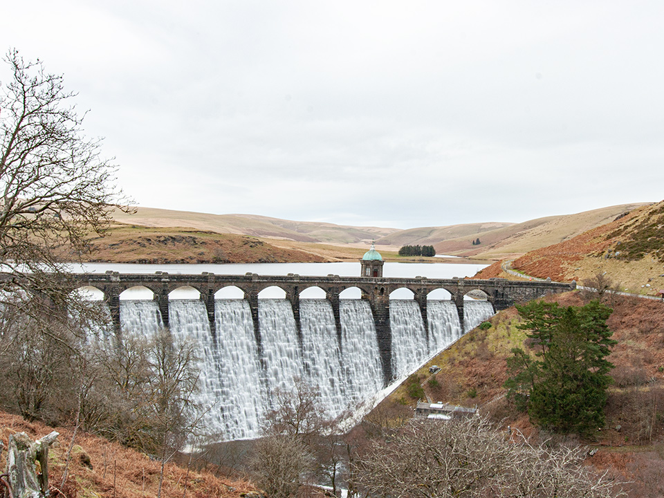
Penygarreg Reservoir and dam
Penygarreg Reservoir and dam

Penygarreg Reservoir
Penygarreg Reservoir

Afon Claerwen
Afon Claerwen

from Claerwen dam
from Claerwen dam

Nantgwyllt Chapel and Garreg-ddu Reservoir
Nantgwyllt Chapel
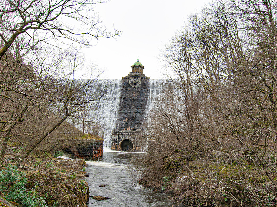
Nant-y-Gro dam
Nant-y-Gro dam

IMG_0556_960
Claerwen dam

Claerwen dam
Claerwen dam

Claerwen dam
Claerwen dam
Garreg-ddu Reservoir
Garreg-ddu Reservoir
Garreg-ddu Reservoir
Garreg-ddu Reservoir
Penygarreg dam
Penygarreg dam

Penygarreg Reservoir
Penygarreg Reservoir

On Rhos y Gelynnen
On Rhos y Gelynnen

On Rhos y Gelynnen
On Rhos y Gelynnen

Afon Elan
Afon Elan
Craig Goch dam
Craig Goch dam

Caban-coch Reservoir
Caban-coch Reservoir

Caban-coch dam
Caban-coch dam

Garreg-ddu Reservoir
Garreg-ddu Reservoir
Afon Elan
Afon Elan
Claerwen dam
the main face of the Claerwen dam
Penygarreg dam
Penygarreg dam

Garreg-ddu Reservoir
Garreg-ddu Reservoir
Graig Dolfaenog
Graig Dolfaenog
Afon Claerwen
Afon Claerwen
Penglaneinon Meadow
Penglaneinon Meadow
Afon Claerwen
Afon Claerwen, Elan Valley
IMG_0172_960
in Cnwch Wood

Penygarreg dam
Penygarreg dam
Claerwen Reservoir
Claerwen Reservoir
Garreg-ddu Reservoir
Garreg-ddu Reservoir
Graig Dolfaenog
Graig Dolfaenog
Penygarreg reservoir
Penygarreg reservoir

Craig Goch dam
Craig Goch dam
The Monks’ Trod

The Monks’ Trod is a 24-mile long old trackway that linked the great medieval Cistercian abbeys of Abbey Cwmhir in Radnorshire and Strata Florida in Ceredigion to the west.
Its course runs generally west from Abbey Cwmhir, crossing Moel Hywel and descending to St Harmon, passing through Gilfach nature reserve before crossing the River Wye at Pont Marteg and rising up, via Nannerth, towards Pont ar Elan, north of the Elan Valley Reservoirs; for a short length here it runs along the top of the band of hills separating Dernol from the Elan Valley. It then turns south-west, passing north of the western point of the Claerwen Reservoir, before passing the Teifi Pools and descending through Troed y Rhiw to Strata Florida.
In many places the Monks’ Trod survives as a well-built, terraced road, the product of a `cut and fill’ method of construction, piling earth and rubble onto the downhill side to create a flat track; in other places it is little more than a boggy track. In recent years parts of it, including SSSIs, have been damaged by off-road vehicles, and to a far lesser extent by cyclists, walkers and horse-riders; in 2002 a temporary TRO, banning all use by motor vehicles, was implemented, though various organisations are lobbying to have this removed. Currently (late 2020) Powys County Council has stated that there will be a public consultation about an environmental assessment in respect of proposed work to restore some of the worst-damaged parts near Rhayader.
Abbey Cwmhir (aerial view) photo credit : CADW / Visit Wales, CC BY-SA 3.0, https://commons.wikimedia.org/w/index.php?curid=25032813
Strata Florida (archway) photo credit : William M. Connolley. CC BY-SA 3.0, https://commons.wikimedia.org/w/index.php?curid=1987499
The Cambrian Mountains

Carn-y-Groes
Carn-y-Groes
Plynlimon
Plynlimon

Nant-y-Moch
Nant-y-Moch
Devil’s Bridge valley
Devil’s Bridge valley

Plynlimon Cairns
Plynlimon Cairns
Llanidloes, from Blaen-y-Glyn
Llanidloes, from Blaen-y-Glyn

Brocken Spectre at Gilfach
Brocken Spectre at Gilfach
The Cambrian Mountains lie between their better-known neighbours, the Snowdonia and Brecon Beacons National Parks, and are a peaceful, largely unspoiled landscape with a rich cultural history and vibrant natural beauty. Read more on the Cambrian Mountains Society website.
The Cambrian Mountains on Discover Ceredigion website
Mynyddoedd Cambrian Mountains, the Cambrian Futures website.
Cambrian Mountains on the Llanidloes website, which includes a video guide to climbing Plynlimon.